
ROOF & Solar Inspections
From Aerial Capture to Actionable Data
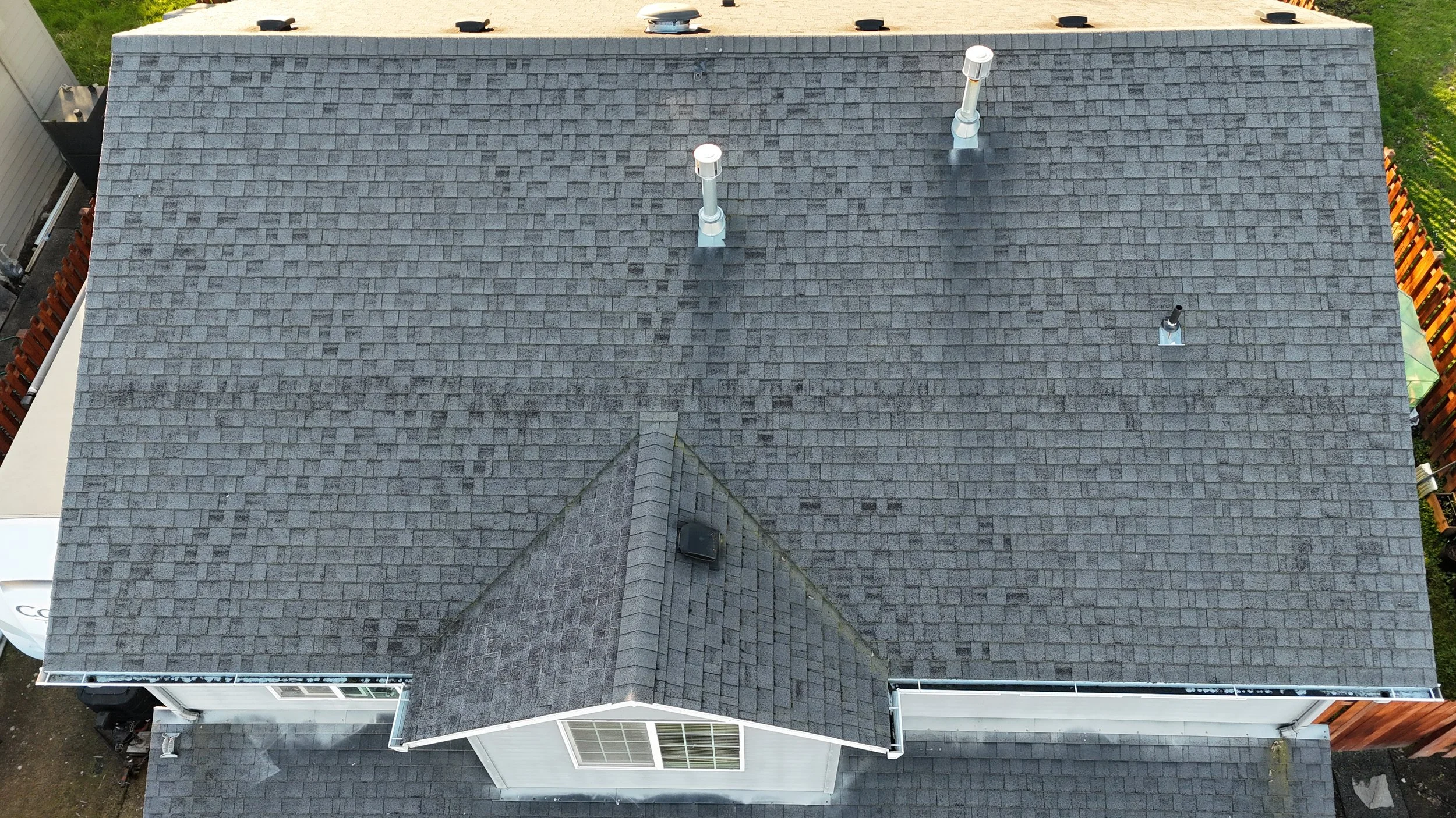
High-resolution imagery for inspections and documentation
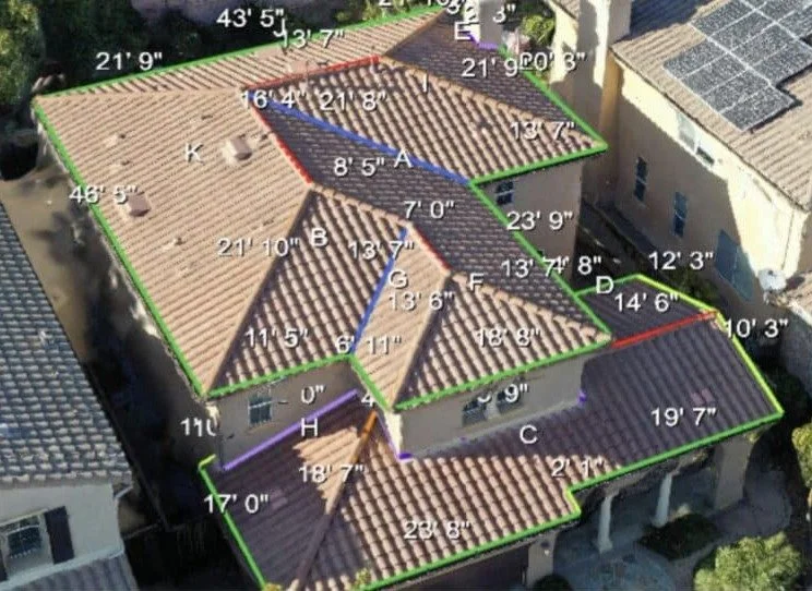
Precise roof measurements for estimates and planning
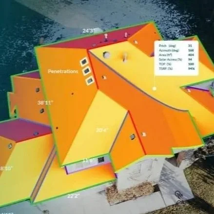
Solar-ready analysis for layout and production planning
Powered by industry-standard software and drone data capture
Everything You Need in One Visit
One drone flight can capture the imagery, measurements, and solar planning data needed for inspections, estimates, and design—without climbing, guessing, or repeat site visits.
Full roof imagery and documentation
Accurate roof measurements
Solar shading and layout data
Reports for planning and proposals
Faster decisions with fewer return visits
No more second visits. No more redesigns. Just accurate data the first time.
Stop Climbing Roofs. Stop Guessing.
Traditional inspections are slow, risky, and often incomplete. Climbing roofs, hand measurements, and outdated imagery lead to missed details, inaccurate estimates, and costly return visits.
These problems cost you time, money, and missed opportunities.
Missed measurements that lead to change orders
Time lost going back to job sites
Safety risks from climbing roofs
Inaccurate data from satellite imagery
There’s a faster, safer, and more accurate way to capture everything the first time.
Capture accurate measurements, detailed imagery, and solar-ready data—all from a single visit.
A Better Way to Capture Roof & Solar Data
Capture
High-resolution aerial imagery provides a complete view of the roof—without climbing or missing critical details.
Measure
Accurate roof measurements, pitch, and layout data eliminate guesswork and prevent costly errors.
Plan
Solar-ready analysis and reporting help you design faster, close more jobs, and maximize system performance.
Everything you need to inspect, estimate, and plan—captured right the first time.
BUILT FOR CONTRACTORS WHO NEED ACCURATE DATA FAST
If your work depends on accurate roof and solar data, this is built for you.
ROOFING CONTRACTORS
No climbing for measurements
Faster, more accurate estimates
Fewer change orders and callbacks
Clean documentation for insurance and clients
Solar CONTRACTORS
Accurate shading and layout data
Better system design and more accurate production estimates
Close deals with confidence
Reduce site revisits and delays
REMODELERS & GCs
Document existing roof conditions before work begins
Identify layout, penetrations, and problem areas
Improve bid accuracy and reduce change orders
Coordinate trades with clear aerial data
If you need accurate data the first time—this replaces guesswork completely.
READY TO CAPTURE ACCURATE DATA ON YOUR NEXT PROJECT?
Get accurate roof measurements, detailed imagery, and solar-ready data in one visit—so you can estimate faster, reduce risk, and win more jobs.
Same-day data delivery on most projects
Typical turnaround: 24–48 hours
Serving roofing, solar, and general contractors across McMinnville, Salem, Portland, and surrounding areas.
Licensed • Insured • FAA Certified • Based in McMinnville